Saturday, May 25, 2013
Friday, May 24, 2013
Memorial Day Weekend Weather Summary
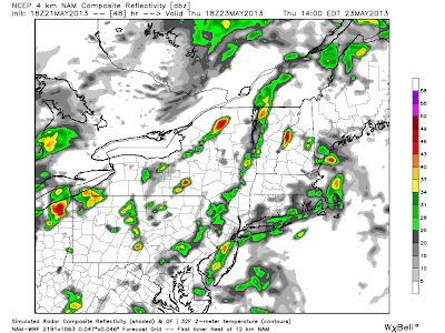
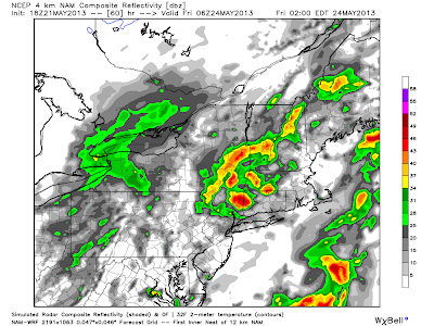
This weekend will be generally normal, with slightly below average temperatures. First lets start with today, today will feature some clouds and even rain showers in the morning around the region especially in New England, eventually fading into mostly sunny skies region wide, except in New England where the showers will continue, with temperatures falling to near 40 degrees by tomorrow evening around New England. The temperatures across the area should be below normal for the first day of the Memorial Day Weekend, with temperatures anywhere from five degrees below normal in Pennsylvania to 25 degrees below normal in New England. But don't let this forecast keep you away from the grill because these temperatures will warm up by Sunday and Monday.
On Sunday, the weather should clear out for the most part, but some morning showers in New England are possible. Otherwise the region will be mainly dry with sunny skies from New York, into Pennsylvania. The temperatures will rebound slightly with conditions warming close to 70 in Pennsylvania to the low to middle 60's in New England, which is a big improvement from highs in the lower 50's on Saturday. Overall the temperatures on Sunday should be around 5 - 10 degrees below average region wide, but the sunny skies that will shine in New York and Pennsylvania will make it feel warmer than it actually will be. So now we can start cooking the hot dogs and hamburgers. But you probably won't want to get in the pools just yet!
For Memorial Day, temperatures will most likely go back to what we would expect for this time of year. The Weather should be precipitation free for almost all of the region with some scattered rain drops in down east Maine. But for most likely everywhere else, sunny skies should prevail. Now you can have a great time outside, with cold days just before, there may be slightly less bugs out there also, so your in good shape for the Memorial Day Holiday. Thanks for reading and keep here at Northeast Weather Action for all weather related forecasts and predictions, as well as updates and great maps! Have a great three day weekend!
Labels:
Rainy Weather,
Temperature Weather,
Weekend Weather
Thursday, May 23, 2013
The Heat Will Be Here Soon!
I made a post on the possibility of summer heat impacting our region about five 5 days ago, when the probability was still very uncertain, but now the models are really indicating a powerful and long lasting heat-wave for the end of May into the start of June. Models show true summer temperates arriving around Wednesday May 29th, where temperatures in the middle 80's are everywhere from Harrisburg, Pennsylvania to Albany, New York. Overall, models are showing about 5 - 10 degrees above average, but this is just at the start of the heat wave. And yes, I am calling this a heat-wave because, well just read the rest and you will definitely see why. After we get through the wimpy start of this, temperatures fly into the 80's and 90's according to the models, which are pretty confident on this solution.
Now the real heat in this event should start around May 30 - 31. During this time period, temperatures should reach the upper 80's as far north as Syracuse, New York. Some models even show southern Pennsylvania reaching the middle 90's, and even close to 100 degrees in Virginia. But things might not get that hot, bu the possibility is there. Through this heatwave, the hot temperatures look to be nonstop, with highs constantly hitting the 90's from PA, south, and 80's from central Vermont, south. This is a major heat-wave and overall is typical for this time of year, because almost every year, sometime in late May - the middle of June, there is the first heatwave of the year here in the northeast. Also, overall, precipitation should be around average during this period, but any severe threats during this heat-wave could be bad, do to the hot temperatures that could light up these thunderstorms.
For the end of this heat-wave, it generally looks like around June 6th - June 9th. But this is still very uncertain, just because of how far out this is, but the heatwave in general is now becoming more realistic and the probability of it is very high now. Overall, it definitely looks like everywhere in the northeast will be affected by this, as the models even show southern Maine reaching the lower 80's. So if you are wondering exactly what the models look like, or just where I am getting some of my ideas from, here are the model going from the first part of the heat-wave to the last. Keep the AC running because it will be hot. Thanks for reading, and be sure to stay tuned for any changes or updates in this forecast, as well as for any possible severe weather events during the heat-wave, along with any weather events here in the northeast, to Northeast Weather Action. Stay safe!
Wednesday, May 22, 2013
Tuesday, May 21, 2013
May 19th, 2013 Moore, Oklahoma Tornado
Yesterday's Moore, OK tornado, packing 200 mph winds will remain as one of the most deadly tornadoes in US history, prayers go out to those affected by this terrible storm, life will never be the same for many in Moore, OK. What you see here is just a sense of how bad this thing really was.
Subscribe to:
Comments (Atom)


