

Showing posts with label Nowcasting Weather. Show all posts
Showing posts with label Nowcasting Weather. Show all posts
Monday, June 24, 2013
Severe Thunderstorm Watch Area Reduced
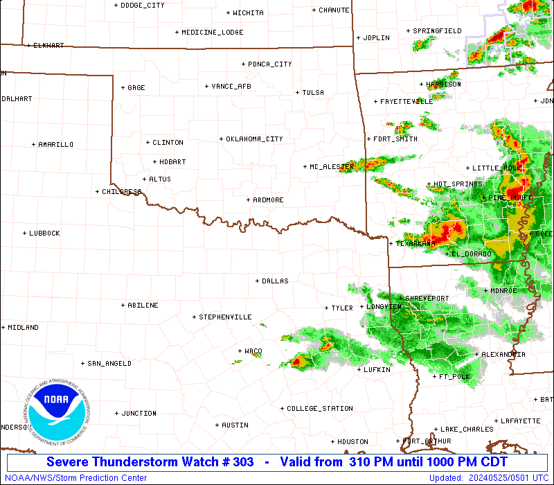
Not current radar, graphic only provided to express reduction of the severe thunderstorm watch box coverage.


Sunday, June 23, 2013
Possible Severe Thunderstorm Watch To Be Issued
| Mesoscale Discussion 1186 | |
| < Previous MD | |
 | |
   MESOSCALE DISCUSSION 1186
   NWS STORM PREDICTION CENTER NORMAN OK
   1201 PM CDT SUN JUN 23 2013

   AREAS AFFECTED...SWRN THROUGH NERN NY...CNTRL VT AND NH

   CONCERNING...SEVERE POTENTIAL...WATCH POSSIBLE

   VALID 231701Z - 231900Z

   PROBABILITY OF WATCH ISSUANCE...40 PERCENT

   SUMMARY...THUNDERSTORMS ARE EXPECTED TO CONTINUE DEVELOPING THIS
   AFTERNOON FROM SWRN THROUGH ECNTRL/NERN NY INTO CNTRL VT AND NH.
   THIS ACTIVITY MAY POSE A MODEST RISK FOR MAINLY LOCALLY STRONG WIND
   GUSTS. SOME SMALL HAIL MIGHT ALSO OCCUR. OVERALL SEVERE RISK DOES
   NOT APPEAR PARTICULARLY ROBUST...SO ANY WW ISSUANCE WILL ULTIMATELY
   DEPEND ON CONVECTIVE TRENDS.

   DISCUSSION...EARLY THIS AFTERNOON STRONG DIABATIC WARMING OF THE
   MOIST BOUNDARY LAYER IS OCCURRING OVER MUCH OF NY AND SRN NEW
   ENGLAND WITH MIDDLE TO UPPER 60S DEWPOINTS AND TEMPERATURES RISING
   THROUGH THE 80S. THE LATEST ANALYSIS SHOWS MLCAPE FROM 1500-2000
   J/KG...AND CUMULUS CONGESTUS IS EVIDENT ALONG SW-NE ORIENTED CLOUD
   STREETS FROM SWRN THROUGH NCNTRL NY. CONVECTIVE INHIBITION IS
   SUFFICIENTLY WEAK AS TEMPERATURES WARM TO UPPER 80S FOR THUNDERSTORM
   INITIATION ALONG LAKE BREEZE CIRCULATIONS. THIS REGION RESIDES
   WITHIN A LOW AMPLITUDE UPPER RIDGE WITH WEAK VERTICAL SHEAR AND
   MODEST DEEP LAYER WINDS SUPPORTIVE OF MULTICELLS. THE WEAK SHEAR
   ENVIRONMENT AND WEAK MID-LEVEL LAPSE RATES MAY ULTIMATELY SERVE AS A
   LIMITING FACTOR FOR A MORE ROBUST SEVERE THREAT. HOWEVER...THE
   DESTABILIZING BOUNDARY LAYER WITH STEEPENING LOW-LEVEL LAPSE RATES
   WILL SUPPORT AT LEAST A MODEST THREAT FOR STRONG WIND
   GUSTS...ESPECIALLY IF STORMS CAN GROW UPSCALE INTO SMALL CLUSTERS OR
   LINE SEGMENTS.

   ..DIAL/KERR.. 06/23/2013


   ATTN...WFO...GYX...BTV...ALY...BGM...BUF...

   LAT...LON   42637765 43127655 43637533 44247309 44017174 43387175
               42537568 42327737 42637765
| |
Saturday, June 22, 2013
All Around Weather Analysis - June 22, 2013
Severe T-Storm Index:
Low Activity
A slight risk for strong to severe thunderstorms runs from Sunday through Wednesday. Minimal activity is expected and chance of impact on your area is low. From Thursday through next weekend, a slight - moderate risk exists for Pennsylvania. New Jersey, New York, as well as all of Southern New England. Isolated activity is possible with risk of impact low to moderate. Main threats: damaging winds in excess of 60 mph and small hail. Probability of a tornado: nearly 0%. Preparation activity needed is nearly nothing, normal thunderstorms could occur in this time period.
Heat Index:
Significant Activity
Slightly above average temperatures are expected throughout the course of the weekend with highs topping out from the 70's to the 80's region wide. A medium duration heat wave is anticipated starting Monday of next weekend, and stretching through midweek, ending Wednesday or Thursday, depending on location. Temperatures will range from 80's in the north to 90's in the south. Thursday - Saturday is expected to have dropping temperatures, about 2 degrees per day. Be sure to drink lots of water and remain hydrated when being exposed to high heat.
Precipitation Index:
Low - Medium Activity
Little to no precipitation is expected from today - Sunday. an increased probability of precipitation will occur Monday and last into the mid to late week as instability is widespread through atmosphere. Maximum chance of precipitation in region: 30%. From Thursday - Saturday, a low pressure system will enter the Ohio, Pennsylvania, and Western New York area. Expected precipitation amounts range from a half an inch in the Northeastern tier on Pennsylvania to near an inch in Northwestern Pennsylvania. Maximum probability of rainfall at current point: 50%.
Drought Index:
Low Activity
An abnormally dry time period with the lack of precipitation could lead to a lack of plant growth. No drought conditions are expected at this time in any part of the region. A relief is likely to come later next week. Area most at risk of below normal precipitation is in the lakes region on Central New York. Any change in forecast has a minimum chance of occurrence.
Tropical Index:
Medium Activity
No tropical activity is expected to to the unfavorable upper and mid level wind conditions at this point, causing increased levels of shear across common tropical development region. Long range index includes an increased possibility for tropical development in the Caribbean. Probability of tropical entity forming in next 10 - 15 days remains around moderate. Keep informed on all development by keeping track of all National Hurricane Center updates and forecasts.
Low Activity
A slight risk for strong to severe thunderstorms runs from Sunday through Wednesday. Minimal activity is expected and chance of impact on your area is low. From Thursday through next weekend, a slight - moderate risk exists for Pennsylvania. New Jersey, New York, as well as all of Southern New England. Isolated activity is possible with risk of impact low to moderate. Main threats: damaging winds in excess of 60 mph and small hail. Probability of a tornado: nearly 0%. Preparation activity needed is nearly nothing, normal thunderstorms could occur in this time period.
Heat Index:
Significant Activity
Slightly above average temperatures are expected throughout the course of the weekend with highs topping out from the 70's to the 80's region wide. A medium duration heat wave is anticipated starting Monday of next weekend, and stretching through midweek, ending Wednesday or Thursday, depending on location. Temperatures will range from 80's in the north to 90's in the south. Thursday - Saturday is expected to have dropping temperatures, about 2 degrees per day. Be sure to drink lots of water and remain hydrated when being exposed to high heat.
Precipitation Index:
Low - Medium Activity
Little to no precipitation is expected from today - Sunday. an increased probability of precipitation will occur Monday and last into the mid to late week as instability is widespread through atmosphere. Maximum chance of precipitation in region: 30%. From Thursday - Saturday, a low pressure system will enter the Ohio, Pennsylvania, and Western New York area. Expected precipitation amounts range from a half an inch in the Northeastern tier on Pennsylvania to near an inch in Northwestern Pennsylvania. Maximum probability of rainfall at current point: 50%.
Drought Index:
Low Activity
An abnormally dry time period with the lack of precipitation could lead to a lack of plant growth. No drought conditions are expected at this time in any part of the region. A relief is likely to come later next week. Area most at risk of below normal precipitation is in the lakes region on Central New York. Any change in forecast has a minimum chance of occurrence.
Tropical Index:
Medium Activity
No tropical activity is expected to to the unfavorable upper and mid level wind conditions at this point, causing increased levels of shear across common tropical development region. Long range index includes an increased possibility for tropical development in the Caribbean. Probability of tropical entity forming in next 10 - 15 days remains around moderate. Keep informed on all development by keeping track of all National Hurricane Center updates and forecasts.
Monday, June 17, 2013
Today’s Severe T-Storm Threats
It's has been several days since we have had a large scale severe weather event. But today looks to end the cold streak, with a severe thunderstorm watch already prompted across southern New England and eastern New York. With severe thunderstorms firing up, today could have more of an expected severe threat because of the original thinking, while was the majority of the action in terms of severe weather was going to stay Maryland, and to the south. Here is the new map for today's severe thunderstorm threats, and read after the map to see the descriptions of each category.


Extreme Threat: There is an 80 - 99 percent chance you will see a severe thunderstorm within 30 miles.
Significant Threat: There is a 60 - 79 percent chance you will see a severe thunderstorm within 30 miles.
High Threat: There is a 40 - 59 percent percent chance you will see a severe thunderstorm within 30 miles.
Moderate Threat: There is a 20 - 39 percent percent chance you will see a severe thunderstorm within 30 miles.
Low Threat: There is a 1 - 19 percent percent chance you will see a severe thunderstorm within 30 miles.
Thursday, June 13, 2013
Derecho Heading Into Western And Central Pennsylvania
Monday, June 10, 2013
Forecast For Additional Rain This Evening - Tomorrow Night
With areas already receiving in excess of two to as much as 3 inches of rain so far with this event, even more rain is likely as be added to that this evening through tomorrow night. From Northern New Jersey and into New England, mainly heavy rainfall with a few scattered thunderstorms is anticipated, but as you head south, the story changes. In Southern Pennsylvania, a tornado watch is in effect for the possibility of severe thunderstorms that could include damaging winds and possibly tornadoes. Watch out for heavy rain in those storms as well. The watch is until 10:00 PM EST. After today finishes up, tonight a front will come through, and you might think everything is wrapped up. Well it's not because behind this front, more showers and thunderstorms will be around the region. So stay tuned to Northeast Weather Action for the latest updates as well as forecasts and outlooks on all Northeast weather action. Here is the forecast for additional rainfall amounts that will fall between this evening and tomorrow night.

Friday, June 7, 2013


Thursday, June 6, 2013

Wednesday, June 5, 2013

New NHC Update As Of 5:00 PM EST On Invest 91L

1. A BROAD AND ELONGATED AREA OF LOW PRESSURE OVER THE CENTRAL GULF OF
MEXICO CONTINUES TO PRODUCE A LARGE AREA OF THUNDERSTORMS AND WINDS
TO NEAR GALE FORCE OVER THE SOUTHEASTERN GULF OF MEXICO.  SATELLITE
AND SURFACE DATA SUGGEST THAT THE CIRCULATION REMAINS POORLY
DEFINED...HOWEVER AN AIR FORCE RESERVE RECONNAISSANCE AIRCRAFT IS
SCHEDULED TO INVESTIGATE THE DISTURBANCE THIS AFTERNOON.  ALTHOUGH
ENVIRONMENTAL CONDITIONS ARE NOT CONDUCIVE FOR SIGNIFICANT
DEVELOPMENT...THERE IS POTENTIAL FOR THIS SYSTEM TO BECOME A
TROPICAL DEPRESSION OR STORM BEFORE IT MOVES ACROSS NORTHERN
FLORIDA LATE THURSDAY OR THURSDAY NIGHT.  THIS SYSTEM HAS A HIGH
CHANCE...60 PERCENT...OF BECOMING A TROPICAL CYCLONE DURING THE
NEXT 48 HOURS.
THIS SYSTEM HAS ALREADY PRODUCED TORRENTIAL RAINS AND FLOODING
OVER THE EASTERN YUCATAN PENINSULA AND WESTERN CUBA.  REGARDLESS
OF DEVELOPMENT...ADDITIONAL HEAVY RAINS AND GUSTY WINDS ARE
EXPECTED OVER THE FLORIDA KEYS AND THE FLORIDA PENINSULA DURING
THE COUPLE OF DAYS.  ISOLATED TORNADOES ARE ALSO POSSIBLE OVER
THE FLORIDA PENINSULA LATE TONIGHT THROUGH THURSDAY.  ADDITIONAL
INFORMATION ON THIS SYSTEM AND ITS EFFECTS CAN BE FOUND IN HIGH
SEAS FORECASTS ISSUED BY THE NATIONAL WEATHER SERVICE...AND IN
PRODUCTS ISSUED BY YOUR LOCAL NATIONAL WEATHER SERVICE OFFICE OR
NATIONAL METEOROLOGICAL SERVICE.
Monday, June 3, 2013
Potential Severe Thunderstorm Watch To Be Issued

The Storm Prediction Center is currently monitoring this area and questioning whether or not to issue a Severe Thunderstorm Watch. Storms are currently firing up in this region and could turn severe. Although a Severe Thunderstorm Watch will most likely not be issued, keep a look out for potential severe and strong storms around this region.
Thursday, May 23, 2013

Wednesday, May 15, 2013

Monday, May 13, 2013
Early Thoughts For The 2013 - 2014 Winter Season
As we finish up this winter and head into spring and summer, we have had everything from record warmth to frigid temperatures and intense snowstorms. Now we head into the summer in just over a month, and it's already the middle of May. So yes, we already have early thoughts on next winter. Now keep in mind, these are very preliminary thoughts and could easily be turned around completely, but this is what we think could possibly play out for the winter of 2013 - 2014. If you have heard of the ENSO, this stands for the El Nino - Southern Oscillation. To summarize this factor, waters of the western side of the South American coast fluctuate from warm to cold, if you don't know the location I am exactly talking about, here is a map showing the area.

Now that you know where this region is, lets go a little more in depth, the seas surface water temperatures dictate greatly whether an El Nino or a La Nina will occur. If the water is warm in the region, it will be an El Nino. If the water is cold, it will be an La Nina. Now you might have thought, what if the water is warm, but now that warm compared to if the water is very warm. Well if the water is barely cold or warm, it's a weak El Nino / La Nina. Now if the water were to be pretty warm, but not very warm and not barely warm, then it is called a moderate El Nino / La Nina. Lastly, if the water is very warm or cold, then a strong El Nino / La Nina will happen. These facts are the basics to learning this impotent region.
For this winter, it looks either some sort of La Nina will form, or a weak to moderate El Nino. Now how I think one of these events could happen are based on the current actions of the sea surface temperatures in this region and the model guidance for the future on this area. Now lets start with the current conditions in this region. In March through the middle of April, warm waters took over the area and formed a weak - moderate El Nino. But this didn't last long because now the warm waters are beginning to vanish from the area. Especially right around the coastal regions, the cold waters of a La Nina are starting to take over. Here is a graphic from the CPC showing the past water of the region.

Now when I look at this map, the one thing that really stands out to me is how the oranges representing the warm waters are really receding from the area close to the coast and now only the light yellow and white colors remain. After that, another thing that stands out is the warm waters off central America, this does not greatly impact the El Nino / La Nina pattern very much, but is sometimes a site with a growing La Nina. So if you were to only base your forecast on the graphic, you would most likely predict a La Nina. But this is not the only graphic that shows current information. Another is this table that represents the El Nino / La Nina movement in the past leading up to the present.


This is pretty much just showing the same information, just on a graph. The La Nina also easily seen emerging on this survey called the Anomalies. Now the last graphic I wanted to show you about current information relevant to the emerging La Nina is the very recent, weekly movement of the seas surface water temperatures. This map your about to see really shows you the cold water that is taking over the region, and could stay and build, but it also could eventually leave in time for the winter, keep in mind that it's only May, and we still have a few months until we will have a better idea for what will happen with the ENSO, so here is the graphic and then we will take about the future of the region, and I will show you a model for the El Nino / La Nina forecast.

For this outlook information, things could get a little advanced for the average person, so just hang in there. The models show a weak El Nino occurring for the first part of this winter, possibly becoming moderate in the second half of next winter. Now I don't want to get into exacts because we are so far out, but that is what the models are indicating at this point in time. Now the more known models like the ECMWF and the CMC both show a weak to moderate El Nino. But the confidence on the outlook is not great at all and this forecast has a pretty good chance of being off. If you want to see exactly where I am getting this information from, here is the graph showing the model spreadsheet. The second graphic down shows you really how much uncertainty is in this very preliminary outlook.


Another thing you can see is that the neutral winter that we just exited from will most likely not be with us next winter, and that is that thing I am most confident on. Now I know you are wondering this, what happens with an El Nino / La Nina in play, what are the effects on the US? Well because we are possibly looking at a weak to moderate El Nino, here are the effects of a weak to moderate El Nino. There is normally a high just south of Alaska that forces the jet stream north over that high and then the jet stream skips the western US and dives down into the eastern United states. Causing mild temperatures in the northwest and north central US and colder temperatures on the east coast.
After that, there is normally a region in the southwest, in California and western Arizona is wetter then normal and the southeast and east coast is also normally west. Most often, the southeast has lots of rain and the northeast is snowy because of the above average moisture on the east coast and the cold air. But if we were to have a strong El Nino, which is not likely, but there would be almost the opposite, but that is not likely to occur. Now here is a map showing the impacts on the US when there is a weak to moderate El Nino.

These thoughts are my preliminary thoughts but there is still much more to be determined like temperatures and precipitation. Once again, take this outlook with half a grain of salt because anything that I said could change, so don't plan on everything that I said playing out. I should have my next update on the winter outlook sometime in late June, which will be my preliminary 2013 - 2014 Winter Outlook, but the things you have just read are my early thoughts for the 2013 - 2014 winter season. Come back in late June for my preliminary outlook. But as always tune into Northeast Weather Action for the latest weather forecasts and outlooks. Thanks for reading!
Friday, May 10, 2013
Thursday, April 25, 2013
Don't worry, the weekend is almost here! Friday's Highs . . .

Friday's weather will be fairly calm with a few stray showers in New England and northern upstate New York. But besides that, things will be pretty quiet with around average temperatures. The good news is that the weather will remain dry over the weekend and most of next week except for a few showers possible around the lakes and points south of Baltimore. The temperatures will continue to be slightly above average making for a great week of weather from pretty much now until maybe 10 days from now! Enjoy it while it lasts!


Wednesday, April 24, 2013

Tuesday, March 5, 2013


Subscribe to:
Posts (Atom)